

GLOBAL WATER MONITOR & FORECAST
ISciences monitors fresh water resources worldwide and forecasts changes with our Water Security Indicator Model. Each month we document current anomalies and provide forecasts with lead times from 1-9 months. Highlights from recent analyses are presented below. For more information, sign up for our newsletter or contact info@isciences.com.
Blog Posts
Featured


Subscribe to our monthly Water Watch List
Search blog categories
- *Precip/Temp Outlooks 101
- *Press Releases 1
- *Special Topics 16
- *Water Watch Lists 107
- Africa 116
- Australia & New Zealand 102
- Canada 103
- Central Asia & Russia 101
- East Asia 101
- Europe 108
- Mexico & C. Amer. & Carib 106
- Middle East 110
- South America 115
- South Asia 106
- Southeast Asia & Pacific 110
- United States 107
For more information contact info@isciences.com.
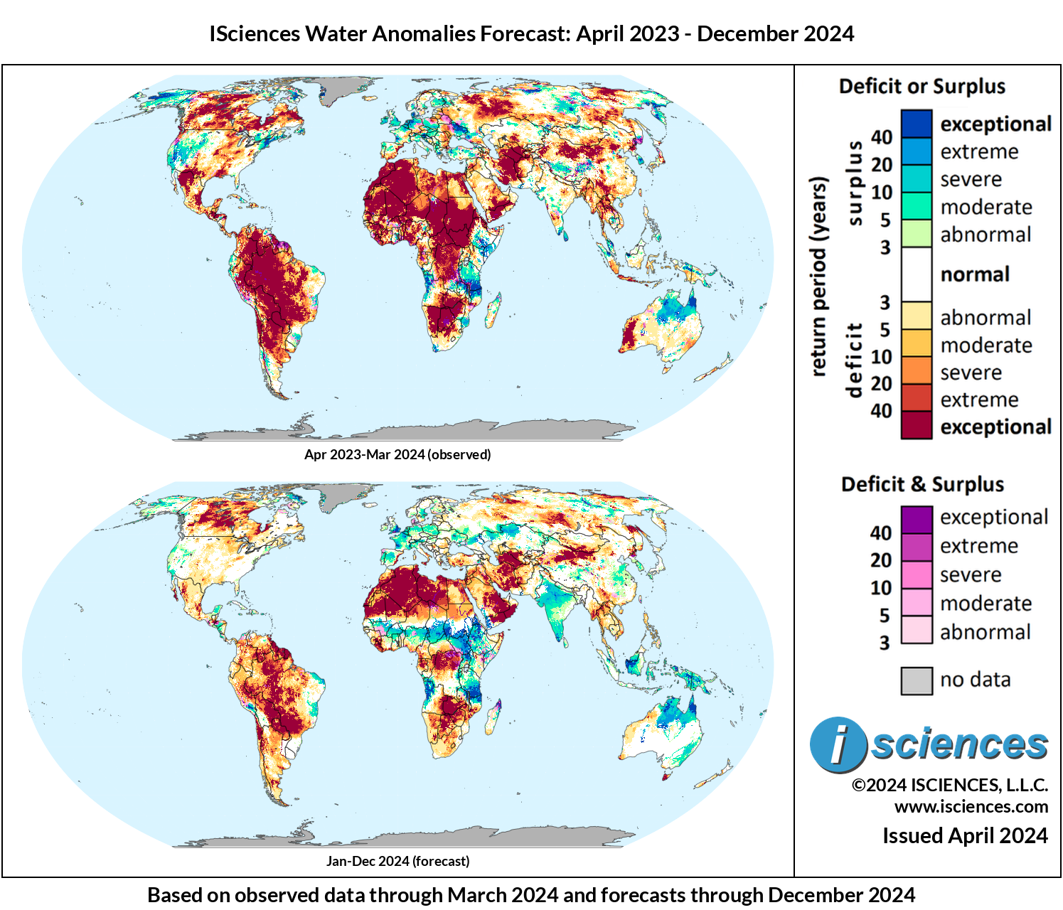
The forecast indicates that intense surplus will occur in most northern and central regions of Australia, with exceptional deficits diminishing in portions of the country near its western coast. Exceptional deficits are expected to emerge in Tasmania, as well as in pockets across New Zealand.